
- Overview
- Situational Awareness
Situational Awareness
Understand the risk in the geographic context.
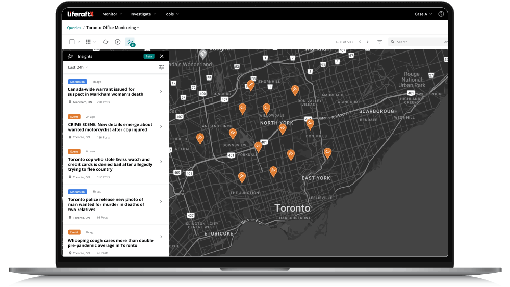
Visualize verified threats on an interactive map to understand what's happening around your people, facilities, travel routes, events, and areas of operation.
Security decisions are stronger when intelligence is viewed in context. Situational Awareness maps analyst-verified threats and incidents in real time, helping teams assess proximity, identify geographic patterns, and understand how events may impact their operations.
The Challenge
The location of a threat is often as important as the threat itself. Without geographic context, security teams can struggle to understand what is relevant to their organization and where action is needed.
-
Analysts spend valuable time reviewing individual alerts and manually determining whether incidents are near key locations, people, facilities, or planned events.
The risk of doing nothing.
Without situational awareness, organizations risk overlooking threats that are geographically relevant, delaying response and making decisions without a complete operational picture.
How It Works
Situational Awareness transforms intelligence into a geographic view of risk. Through mapping analyst-verified threats alongside your areas of interest, security teams can quickly understand what is happening nearby, identify patterns, and determine whether action is required.
Collect
Bring analyst-verified threats and incidents into view.
Map
Plot intelligence on an interactive map.
Monitor
Apply geospatial awareness around people, facilities, travel routes, events, or areas of interest.
Assess
Identify threats occurring within or near your defined locations.
Key Capabilities
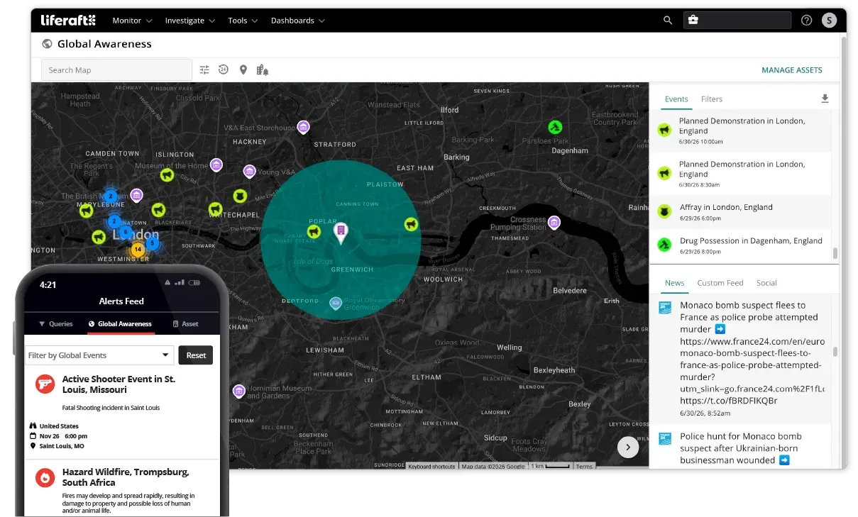
Visualize threats on an interactive map
See analyst-verified threats in real time, giving your team immediate geographic context for security incidents and emerging risks.
Create custom geofences
Monitor activity around offices, critical infrastructure, executive travel, event venues, or any area of interest by defining custom geographic boundaries.
Assess risk based on proximity
Quickly identify threats occurring within or near your people, facilities, travel routes, and operations to prioritize response based on geographic relevance.
Outcomes & Benefits
-
Understand where threats are occurring in relation to your operations.
-
Prioritize incidents based on geographic relevance.
-
Improve planning for travel, events, and critical facilities.
-
Make faster operational decisions with location-based intelligence.
Up to days
Advance warning before civil unrest.
Because of Liferaft, they were getting people posting pictures during the event. They could see the windows being smashed. They had all that information, kind of boots-on-the-ground coverage.
Insider Threat Program Director | Manufacturing
Use Cases
Executive protection
Monitor threats and incidents near executive residences, travel routes, accommodations, and event venues.
Corporate Security
Understand risks around offices, facilities, and other critical assets to support operational planning and incident response.
Event Security
Monitor activity around venues before and during events, helping security teams identify nearby incidents that may require attention.
Safe Passage: Best Practices for Corporate Travel Security in a Global Environment
Ensure corporate travel security with best practices for emerging threats and enhancing employee safety. Download the report to strengthen your strategy.

Frequently Asked Questions
How does Liferaft provide situational awareness?
Liferaft maps analyst-verified threats and incidents in real time, giving security teams the geographic context needed to understand where risks are occurring and whether they are relevant to their people, facilities, travel, events, or operations.
Can I create custom geofences around important locations?
Yes. Liferaft allows you to create custom geofences around offices, critical infrastructure, executive travel, event venues, or any area of interest. You'll receive visibility into threats occurring within or near those locations, helping your team prioritize investigations and response.
Can I monitor threats near executive travel or events?
Yes. Situational Awareness helps security teams monitor analyst-verified threats around executive travel, planned events, accommodations, and other key locations. By understanding what is happening nearby, teams can make more informed security decisions before and during travel or events.
What types of intelligence can be displayed on the map?
The map displays analyst-verified threats and incidents collected through your configured Liferaft queries. Intelligence can be filtered by location, threat type, and other criteria, allowing analysts to focus on the activity most relevant to their organization.
How does Situational Awareness support security operations?
Situational Awareness helps security teams understand where threats are occurring in relation to their people, facilities, and operations. By combining verified intelligence with geographic context, analysts can prioritize incidents, allocate resources more effectively, and respond with greater confidence.
Book a Meeting with Us
Learn how our unified platform for intelligence-driven threat detection, investigation, and collaboration can solve your needs!